
Maritime identification systems
Learn about the systems we use to support our maritime security operations.
Automatic Identification System
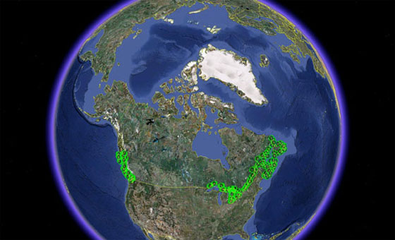
Automatic Identification System coverage across Canada. The green circles represent AIS receivers onboard ships.
The Automatic Identification System tracks vessels and automatically provides the Canadian Coast Guard with their:
- position updates
- relevant voyage data
The system enhances our ability to identify and monitor maritime traffic, and provides awareness of vessels approaching and operating in Canadian waters.
We’re responsible for the construction and operation of shore-based stations in the system network. Stations are built in specific locations to track vessels:
- in the Great Lakes
- in the St. Lawrence Seaway
- within 40 to 50 nautical miles of the coastline
The system is integrated into all of the marine communications and traffic services centres and remote sites. It operates in the very high frequency (VHF) maritime band and is capable of sending a wide range of vessel data to other ships and stations.
Long Range Identification and Tracking of Ships
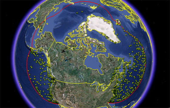
The red line represents the coverage area from the Long Range Identification and Tracking of Ships system. The yellow dots represent ships off of the Canadian coast.
The Long Range Identification and Tracking of Ships system was started by the International Maritime Organization. We use the data from the system to evaluate and respond to possible security risks from ships off our coasts.
Safety of Life at Sea-class vessels must transmit the:
- date and time of their position
- ship's identity, latitude and longitude
This system complements the Automatic Identification System and uses existing shipboard equipment such as the Global Maritime Distress and Safety System.
The Long Range Identification and Tracking of Ships system is used by programs and services like Search and Rescue and Environmental Response to:
- locate and track vessels that are:
- disabled or distressed
- carrying dangerous cargo
- identify the origin of pollution or waste
- Date modified: