
Marine Communications and Traffic Services program information
The 12 Marine Communications and Traffic Services (MCTS) centres across the country provide several services to our clients, including:
- safety radio-communication services
- vessel traffic services and regulation
- information that supports marine activities
- screening of vessels entering Canadian waters
- a 24/7 commercial marine telephone call service
Our program’s objectives are to:
- contribute to safety of life at sea
- support maritime domain awareness
- contribute to safety and efficiency of navigation
- contribute to the protection of the marine environment
Our main priorities are distress, urgency and safety.
Services
The safety radio-communication service is provided via a comprehensive system of terrestrial radio facilities. These enable communications between ships and shore, complementing the Global Maritime Distress and Safety System as well as national and international regulations.
This service provides the Canadian Coast Guard with enhanced information on vessel transit. It’s also responsible for:
- regulating vessel movements
- identifying and monitoring vessels
- providing navigational information and assistance to encourage:
- safety
- efficient navigation
- environmental protection
In selected areas, the marine telephone call service allows ships and land-based customers to exchange telephone calls. The Canadian Coast Guard recovers incremental costs associated with this service.
Atlantic region
The Atlantic region’s area of responsibility includes the:
- Cabot Strait
- Bay of Fundy
- Strait of Belle Isle
- Southern and Eastern Gulf of St. Lawrence
- Labrador Sea south of latitude 60 degrees north
- Canadian Atlantic coastal and offshore waters north of the Hague Line
The Halifax MCTS centre issues clearances to vessels entering Canadian waters from the east, as per the Eastern Canada Vessel Traffic Services Zone Regulations (ECAREG).
Navigational Warning (NAVWARN) services are provided by the Sydney and Port aux Basques MCTS centres.
Map of the Atlantic region showing New Brunswick, Nova Scotia and Prince Edward Island
Basemap information used under Open Government License from Natural Resources Canada.
© Her Majesty the Queen in Right of Canada, as represented by the Minister of Natural Resources.
Map of the Atlantic region showing New Brunswick, Nova Scotia and Prince Edward Island - text version
The Halifax MCTS centre is in central Nova Scotia, with remote controlled sites in these locations.
| Name | Location |
|---|---|
| Ecum Secum | Central Nova Scotia |
| Chebucto Head | Central Nova Scotia |
| Sambro | Central Nova Scotia |
| Kingsburg | South Nova Scotia |
| Lockeport | South Nova Scotia |
| Yarmouth | South Nova Scotia |
| Tiberton | Central Nova Scotia |
| Cape Blomidon | South New Brunswick |
| Grand Manan | South New Brunswick |
| Letite | South New Brunswick |
| Saint John | South New Brunswick |
| Scotch Mountain | South New Brunswick |
The Sydney MCTS centre is in eastern Nova Scotia, with remote controlled sites in these locations.
| Name | Location |
|---|---|
| Cape Egmont | Prince Edward Island |
| Montague | Prince Edward Island |
| Cheticamp | North Nova Scotia |
| Kilkenny Lake | North Nova Scotia |
| Port Caledonia | North Nova Scotia |
| St. Columbia | North Nova Scotia |
| Eddy Point | North Nova Scotia |
| Fox Island | North Nova Scotia |
Map of the Atlantic region showing Newfoundland and Labrador

Basemap information used under Open Government License from Natural Resources Canada.
© Her Majesty the Queen in Right of Canada, as represented by the Minister of Natural Resources.
Map of the Atlantic region showing Newfoundland and Labrador - text version
The Goose Bay MCTS centre is in southern Labrador, with remote controlled sites in these locations.
| Name | Location |
|---|---|
| Nain | North Labrador |
| Hopedale | North Labrador |
| Cartwright | East Labrador |
| Fox Harbour | East Labrador |
| L’anse aux Meadows | North Newfoundland |
| St. Anthony | North Newfoundland |
| Conche | North Newfoundland |
| Twilingate | North-east Newfoundland |
| Comfort Cove | North-east Newfoundland |
The Port aux Basques MCTS centre is in south-west Newfoundland, with remote controlled sites in these locations.
| Name | Location |
|---|---|
| Pointe Riche | North Newfoundland |
| Bonne Bay | North-west Newfoundland |
| Mount Moriah | West Newfoundland |
| Pinetree | West Newfoundland |
| Stephenville | West Newfoundland |
| Table Mountain | South-west Newfoundland |
| Ramea Island | South Newfoundland |
The Placentia MCTS centre is in south-east Newfoundland, with remote controlled sites in these locations.
| Name | Location |
|---|---|
| Hermitage | South Newfoundland |
| Fortunehead | South Newfoundland |
| St. Lawrence | South Newfoundland |
| Bay L’Argent | South Newfoundland |
| Arnold’s Cove | South-east Newfoundland |
| Cuslett | South-east Newfoundland |
| Cape Pine | South-east Newfoundland |
| St. John’s | South-east Newfoundland |
| Victoria | South-east Newfoundland |
| Cape Bonavista | East Newfoundland |
| Lumsden | North-east Newfoundland |
Arctic region
The Arctic region’s area of responsibility includes:
- James Bay
- Hudson Bay
- the Canadian waters of the Arctic
- the Athabasca-Mackenzie watershed
The Iqaluit MCTS centre performs Alert and Warning Network (AWN) desk duties and provides Navigational Warning services. The centre operates seasonally.
Map of the Arctic region showing Nunavut and North West Territories
Basemap information used under Open Government License from Natural Resources Canada.
© Her Majesty the Queen in Right of Canada, as represented by the Minister of Natural Resources.
Map of the Arctic region - Text version
The Iqaluit MCTS centre is in south-east Nunavut, with remote controlled sites in these locations.
| Name | Location |
|---|---|
| Cambridge Bay | West Nunavut |
| Coral Harbour | South Nunavut |
| Killinek | South-east Nunavut |
| Resolute | North Nunavut |
| Enterprise | South North-West Territories |
| Hay River | South North-West Territories |
| Inuvik | North-west North-West Territories |
| Parson’s Lake | North-west North-West Territories |
| Yellowknife | South North-West Territories |
| Churchill | North-east Manitoba |
Central region
The Central region’s area of responsibility includes:
- Lake Winnipeg
- the Great Lakes Basin
- the St. Lawrence Waterway
Navigational Warning services are provided by the Prescott MCTS centre.
The Les Escoumins MCTS centre provides ECAREG functions.
The Quebec MCTS centre performs Alert and Warning Network (AWN) desk duties.
Map of the Central region showing Ontario and Manitoba
Basemap information used under Open Government License from Natural Resources Canada.
© Her Majesty the Queen in Right of Canada, as represented by the Minister of Natural Resources.
Map of the Central region showing Ontario and Manitoba - text version
The Prescott MCTS centre is in south-east Ontario, with remote controlled sites in these locations.
| Name | Location |
|---|---|
| Cornwall | South-east Ontario |
| Cardinal | South-east Ontario |
| Gananoque | South-east Ontario |
| Kingston | South-east Ontario |
| Cobourg | South-east Ontario |
| Orillia | South-east Ontario |
| Trafalgar | South-east Ontario |
| Fonthill | South-east Ontario |
| Long Point | North-west Lake Winnipeg, Manitoba |
| Jackhead | West Lake Winnipeg, Manitoba |
| Beaver Creek | West Lake Winnipeg, Manitoba |
| Fraserwood | South Lake Winnipeg, Manitoba |
The Sarnia MCTS centre is in south-east Ontario, with remote controlled sites in these locations.
| Name | Location |
|---|---|
| Rabbit Mountain | South Ontario |
| Horn | South Ontario |
| Bald Head | South Ontario |
| Sault Ste. Marie | South Ontario |
| Silver Water | South-east Ontario |
| Killarney | South-east Ontario |
| Pointe au Baril | South-east Ontario |
| Tobermory | South-east Ontario |
| Wiarton | South-east Ontario |
| Meaford | South-east Ontario |
| Kincardine | South-east Ontario |
| Camlachie | South-east Ontario |
| Grande Pointe | South-east Ontario |
| Leamington | South-east Ontario |
| Rondeau | South-east Ontario |
| Port Burwell | South-east Ontario |
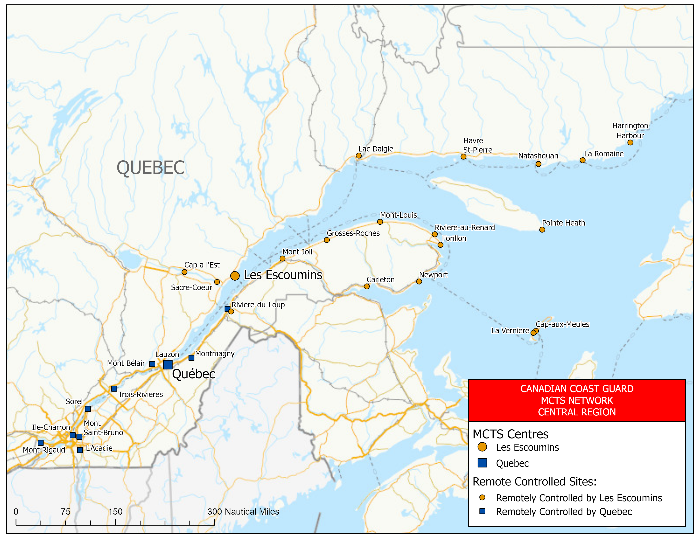
Map of the Central region showing Quebec.
Basemap information used under Open Government License from Natural Resources Canada.
© Her Majesty the Queen in Right of Canada, as represented by the Minister of Natural Resources.
Map of the Central and Arctic region showing Quebec - text version
The Quebec MCTS centre is in south Quebec, with remote controlled sites in these locations.
| Name | Location |
|---|---|
| Mont Rigaud | South Quebec |
| Ile-Charron | South Quebec |
| L’Acadie | South Quebec |
| Mont Saint-Bruno | South Quebec |
| Sorel | South Quebec |
| Trois-Rivieres | South Quebec |
| Mont Bélair | South Quebec |
| Lauzon | South Quebec |
| Montmagny | South Quebec |
| Riviere-du-Loup | South Quebec |
The Les Escoumins MCTS centre is in south Quebec, with remote controlled sites in these locations.
| Name | Location |
|---|---|
| Cap a l’Est | South Quebec |
| Sacre Coeur | South Quebec |
| Riviere-du-Loup | South Quebec |
| Mont-Joli | South-east Quebec |
| Grosses-Roches | South-east Quebec |
| Mont-Louis | South-east Quebec |
| Riviere-au-Renard | South-east Quebec |
| Forillon | South-east Quebec |
| Newport | South-east Quebec |
| Carleton | South-east Quebec |
| La Verniere | South-east Quebec |
| Cap-aux-Meules | South-east Quebec |
| Pointe Heath | South-east Quebec |
| Lac Daigle | South-east Quebec |
| Havre St-Pierre | South-east Quebec |
| Natashquan | South-east Quebec |
| La Romaine | South-east Quebec |
| Harrington Harbour | South-east Quebec |
Western region
The Western region’s area of responsibility includes the coastal and offshore waters of the Pacific Ocean.
The Prince Rupert MCTS centre provides Navigational Warning (NAVWARN) services.
Vessel traffic offshore functions are provided by the Prince Rupert MCTS centre, which issues clearances to vessels entering Canadian waters from the west.
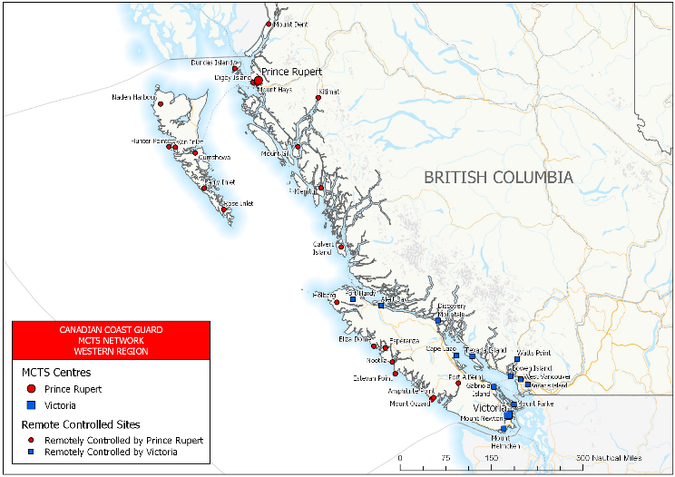
Map of the Western region, showing British Columbia
Basemap information used under Open Government License from Natural Resources Canada.
© Her Majesty the Queen in Right of Canada, as represented by the Minister of Natural Resources.
Map of the Western region, showing British Columbia - text version
The Prince Rupert MCTS centre is in western British Columbia, with remote controlled sites in these locations.
| Name | Location |
|---|---|
| Mount Dent | West British Columbia |
| Dundas Island | West British Columbia |
| Digby Island | West British Columbia |
| Mount Hays | West British Columbia |
| Kitimat | West British Columbia |
| Mount Gil | West British Columbia |
| Klemtu | West British Columbia |
| Calvert Island | West British Columbia |
| Holberg | North Victoria Island, British Columbia |
| Eliza Dome | West Victoria Island, British Columbia |
| Nootka | West Victoria Island, British Columbia |
| Estevan Point | West Victoria Island, British Columbia |
| Amphitrite Point | West Victoria Island, British Columbia |
| Mount Ozzard | West Victoria Island, British Columbia |
| Port Alberni | Central Victoria Island, British Columbia |
| Naden Harbour | Graham Island, British Columbia |
| Hunter Point | Graham Island, British Columbia |
| Van Inlet | Graham Island, British Columbia |
| Cumshewa | Moresby Island, British Columbia |
| Barry Inlet | Moresby Island, British Columbia |
| Rose Inlet | Moresby Island, British Columbia |
The Victoria MCTS centre is on Victoria Island, British Columbia, with remote controlled sites in these locations.
| Name | Location |
|---|---|
| Port Hardy | North Victoria Island, British Columbia |
| Cape Lazo | East Victoria Island, British Columbia |
| Gabriola Island | South Victoria Island, British Columbia |
| Mount Parke | South Victoria Island, British Columbia |
| Mount Newton | South Victoria Island, British Columbia |
| Mount Helmcken | South Victoria Island, British Columbia |
| Alert Bay | South-west British Columbia |
| Discovery Mountain | South-west British Columbia |
| Texada Island | South-west British Columbia |
| Watts Point | South-west British Columbia |
| Bowen Island | South-west British Columbia |
| West Vancouver | South-west British Columbia |
| Annacis Island | South-west British Columbia |
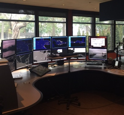
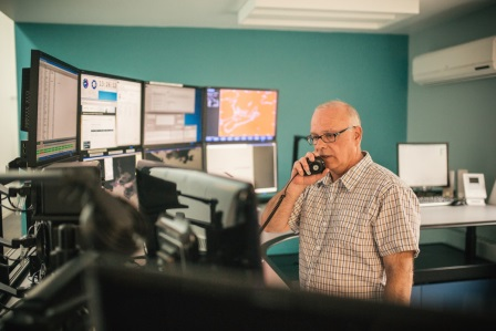
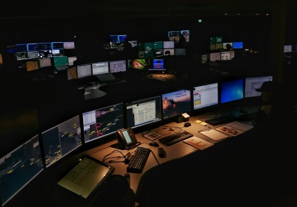
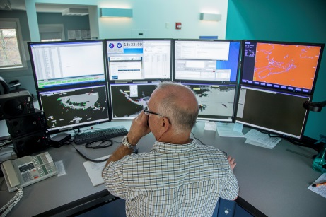
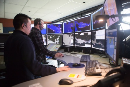
Gallery

- Date modified: